
The Moorland Mission Churches of Caithness (by George Watson)
26th January 2013
This article was first published in the Caithness Field Club Bulletin 2011.
Today there are few traces of the active missionary movement which once transcended parish and county boundaries to cater for a surprisingly large population in the moorland areas of Caithness. At the Union of the Parliaments in 1707 a separate Act had confirmed the Presbyterian form of church government in Scotland. Leaders no longer had to worry about Episcopal intrusions or Royal impositions and could concentrate on improving the Presbyterian church within the country. The Society for the Propagation of Christian Knowledge (SPCK), formed in 1709 to further Christian education, initially had limited finance and made slow progress. After 1725 the Society�s work was aided by a committee of the Church of Scotland which administered an annual grant from the Crown of �1000. Between them they assisted the provision of missionaries and schoolmasters, in areas remote from a parish church.
Quite spontaneously, many isolated communities had already come together to support a preacher of their own. Such missionary work was good experience for young ministers, who could work more or less independently, knowing that the advice of more than one parish minister was readily at hand. The hinterland of Halkirk parish was typical: here the residents by their own efforts had provided a mission-house at Dirlot for a preacher, initially the parish minister, but later a resident missionary. One of the early incumbents, though not necessarily the first, was Alexander Sage, appointed in 1784. His accommodation was described [in 1889] as, � a, low uncomfortable cottage of two rooms and a closet, not far from the old ruin of Dirlot�. He preached on successive Sundays at Dirlot, Strathhalladale, and Berriedale, travelling across the moorland in all weathers. These three stations with Dirlot at their hub, were probably established about the same time, although the precise date is unknown. Craigtown in Strathhalladale is mentioned as early as 1726. While the general location of each of these mission stations is well known it is difficult to pin-point the actual buildings. Traces of Alexander Sage�s cottage must lie among the many other foundations near Dirlot castle.
Parish ministers still regarded the congregations of the mission-houses as part of their flock and made infrequent visits to these outlying communities. In 1791 Mr John Cameron of Halkirk said, �he was wont to preach every 4th Sabbath as a voluntary deed, if not prevented by bad weather or speats in the waters. ... The [mission] house is pretty large, was built and is still supported by the inhabitants of that district, ...... at very considerable expence for them. Of late years, they have a missionary supported at their own expence also.� In a footnote he mentioned that Sir John Sinclair had just procured a mission for the parishes of Halkirk and Latheron from the Society, ie the existing stations would in future receive some financial help from the SPCK and the Royal Bounty.
Towards the end of the 18th century and the during early years of the 19th century the Caithness Mission Stations were expanded and re-organised. A new mission erected at Bruan in 1798, was described some forty years later, as a plain thatched building to which an aisle had been added, capable of holding 585 sitters from an immediate population of 1800. Bruan, a few yards inside Wick parish, also served the northern part of Latheron parish and initially shared with Berriedale, a missionary who preached at each station on alternate Sundays. The building of a Parliamentary church at Berriedale (1826) led to it being made a quod sacra parish in 1833. Bruan then continued as separate mission church whose congregation joined the Free Church in 1843. When a new church was built in 1850 the old mission became the Free Church school. Its much modified remains can still be seen beside the empty shell of the later Free Church
No longer reponsible for Berriedale, the missionary at Dirlot now took under his wing a new station at Halsary. It was strategically placed on the very edge of Watten parish close to its conjunction with the parishes of Halkirk and Latheron. Slight traces of the foundations of this building, which could seat 403 out of a surrounding population estimated at 784, can still be found in the hollow to the south of a later meeting house, erected in 1842. This building, now used as a farm store, is still an easily recognised landmark on the Causeymire. At the Disruption, a good portion of its congregation left to join the Free Church, and by the 1920s the remnant had dwindled to such an extent that the building was abandoned. About 50 metres to the east of this site is a prehistoric hut circle, traditionally known as �the kirk in the heather�, probably a euphemism for the primitive toilet arrangements at the first mission building, rather than an ancient chapel site.
It was about this time that a wooden foot-bridge was first constructed across the river at Dirlot for the convenience of inhabitants attending Halsary or Dirlot. In 1805 the Dirlot station itself was moved to new premises at Acharynie about a mile upstream. The Rev John Munro, who had been the missionary there between 1806 and 1815, later became the minister of Halkirk. Writing in 1840, he estimated the total population of the mission area at 2500 with the mission-house at Acharynie capable of seating 403 people. Very slight traces of foundations can be found to the east and north of the present graveyard. The fact that Halsary and Acharynie both held 403 sitters, suggests that the now vanished mission churches were built to a standard design.
By 1830 the Strathhalladale mission had also moved from Craigton, 2� miles down stream to Deasphollag where the T-plan foundations of a thatched church built by the people, with assistance from the Sutherland family, can still be found. It had an average congregation of 550 out of a total population in the Strath of 1125. The missionary from Dirlot continued to serve this new station lying in a part of Farr parish, which for convenience was attached to Reay church.
Family ties ensured the continued use of the older graveyards when the missions transferred to their new sites. New cemeteries were established at Acharynie and around Telford�s church at Berriedale but not at Halsary, Bruan or Deasphollag. This seems to indicate that the development of the older graveyards belongs to the first phase of mission activity in the early 1700s.
At Dirlot, the small pentagonal graveyard sits awkwardly across a filled-in gully on the high bank of the river. Alexander Pope in 1769 described it as a chapel, but Cordiner when he visited the castle seven years later noticed only �an enclosed burying ground, with a number of moss-grown gravestones.� The earliest dated tombstone is 1734 but there are also undated grave markers. In 1833 Mr Gunn of Dale completely re-built the east end of the surrounding wall. Some fifty years later it was reported that in doing so he had used stone from the old chapel which lay at the east end of the cemetery.
The Rev J Munro, author of the New Statistical Account (NSA) is probably the most reliable authority for this site. During his nine years as the missionary at Acharynie, he would have conducted funerals in the old cemetery, when perhaps,the remains of the chapel were still visible. By the time he wrote the NSA, he had been parish minister for a further eighteen years and would have refreshed his memories of Dirlot during later pastoral visits. His account, in 1840, is the first to mention that the chapel was dedicated to St Columba, however he qualified the dedication, by saying �whether [the chapels were] built in their [the saints�] time ..... or after their day, is a subject that must remain in doubt.� He probably realised that in a Gaelic speaking area, the fact that the chapel was not referred to as Cill meant that this was a much later dedication.
The most likely interpretation of the above is that a small chapel/graveyard possibly associated with Dirlot castle, already existed when the mission station was first established. During the early phase of mission activity the graveyard was enlarged by building across the gully, indicating that some unknown factor prevented expansion in other easier directions. Lack of burial space may have been one of the reasons for moving the mission to Acharynie where a new cemetery was established. Rev Munro with his intimate knowledge of the inhabitants, may well have preserved an oral tradition of a late Columban dedication. By 1910 the revived dedication had travelled about 400 metres downstream to a small well, now known as Columba�s Well.
The old graveyard at Berriedale was certainly there in 1795 when Cordiner used this high vantage point to make his sketch of Berriedale with gravestones in the foreground. Several later maps show the mission church slightly further up the hillside, but there are now no recognisable remains in this field. The juxtaposition of the first mission church and the old graveyard at Berriedale appears to place their origin in the early 18th century. About 1908 the Rev AB Scott confused the picture by suggesting a connection between the placename Berriedale and St Barr (or Finbarr), knowing that a pre-Reformation Kalendar placed his birth place somewhere in Cathania, and that there was a local tradition that this was, �a green spot on the banks of the Berriedale Water not very far from the high road that runs from Helmsdale to Wick. ..... Here there was an ancient church and a burying ground.� Fortunately the Rev Scott continued by saying that, � the old inhabitants (who held this tradition) had left the district and the name of the actual spot seems irretrievably lost.� This cannot refer to the old cemetery at Berriedale, which was clearly visible. It would appear that the Rev Scott in his desire to interpret the place-name and link it to an early saint had picked on a garbled account of some other chapel site. One likely candidate lies on the north bank of the Langwell, near Brae-na-h-Eaglaise. This chapel was in use until the Reformation and lies on an early route north, certainly used by Campbell of Glenorchy when he marched into Caithness in 1680.
Given the independent nature of the communities who established and supported these mission stations it is quite understandable that the majority were drawn to the Free Church in 1843. The Disruption virtually ended the mission system although some stations struggled on with much reduced congregations. As late as 1878 the Church of Scotland built a new Mission Church on Stroma, in competition with the Baptist church which had opened the year before. This motivation was quite different from the spontaneous, spiritual drive which inspired isolated communities to create and maintain the earlier mission.
References.
Old and New Statistical Accounts of Halkirk, Latheron Watten and Wick.
Ecclesiastical History of Caithness, Rev D Beaton, 1909.
The Ordnance Survey Name Book. c1872
Strange Tales of the Causeymire, A Sinclair, c1988.
A Tour in Scotland in 1769, Pennant.
Antiquities and Scenery of the North of Scotland, Rev C Cordiner, 1780.
Remarkable Ruins and Romantic Prospects of North Britain, Rev C Cordiner, 1795
Memorabilia Domestica. Sage, 1889.
The Province of Strathnaver, ed JR Baldwin, 2000.
Clyth, H Nicolson, 2004.
The Gunns, T Sinclair, 1890.
Caithness Monumental Inscriptions pre 1855, AS Cowper & I Ross, 1992, Vol 3, page 88.
Map of the soil of Caithness S. in General View of the Agriculture of Caithness, Capt John Henderson, 1812.
Map of Caithness Shire, John Thomson, 1822.
Stroma, ed Donald Young, 1993.
Burial Grounds Of Caithness and Sutherland
Caithness Cemeteries
Related Organisations
Related Articles
Caithness Field Club Winter programme 2019 - 20 February - April
Saturday 22nd February: A walk led by Sharon Pottinger around her patch. It's about 6 miles, mainly on by-roads, so bring a pack lunch.Caithness Field Club Bulletin 2018
Caithness Field Club Bulletin 2018 Articles now added at the link above Caithness Field Club Summer Programme 2018 - See below Field Club Activities during 2017 (by Tony Bradford) Botanical Report 2017 (by Francis and Margaret Higgins) Ranger Wildlife Notes 2017 (by Paul Castle) Strathmore Flora (contributed by Keith Gerry) Allan's Reminiscences (by Allan Abernethy) Place-names - Nottingham and Snottergill Burn (by George Watson) St Donnan - Patron Saint (by Audrey Munro) Thusater Dig (by Caithness Broch Project) Caithness Field Club Trips (by Anna Rogalski) Heads of Heroes (by Geoff Leet) Tale of a Carriage (by Tony Bradford).Hetty Munro's War Diaries by Elizabeth Rintoul - July 1942 - February 1943
First published in the Caithness Field Club Bulletin 2010 Vol 7 No 6. The following extracts from the War Diary of the late Henrietta Munro of Thurso come from the North Highland Archive and are published with their permission.Hetty Munros War Diaries by Elizabeth Rintoul
Hetty Munros War Diaries by Elizabeth Rintoul First published in the Caithness Field Club Bulletin 2011 Vol 7 No7. The following extracts from the War Diary of the late Henrietta Munro of Thurso come from the North Highland Archive and are published with their permission.History of Cabrelli‘s Cafe at the Camps in Wick by Lyndall Leet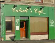
This article was first published in the Caithness Field Club Bulletin 2010 Vol 7 No 6. Early in the 20th century, Italian-owned cafes, ice cream parlours and chip shops spread through- out Scotland, run by enterprising immigrants, who saw Scotland as a land of opportunity, at a time when work was scarce in their own country.
Caithness Field Club Winter programme 2018 - 19
Thursday 29th November at 7:30pm: A talk by Roy Mackenzie on the Veteran's Tower, in the Smith Room at the Pulteney Centre, Huddart Street, Wick Tuesday 22nd January 2019 at 7:30pm in the Pentland Hotel, Thurso: A talk by Lydia Fensome on bygone bikes, illustrated by some in her own collection. Saturday 9th February 2019: A walk, led by Joy and Tony, around Achvarasdal, to see the broch.Caithness Field Club - Events March to May 2018
Caithness Field Club Winter programme 2018. Tuesday 20th March at 7-30pm: A talk Iain MacLean of Caithness Broch Builders Project on latest findings: in Pentland Hotel, Thurso.CAITHNESS FIELD CLUB PROGRAMME 2016-17
Sunday 2 October 2016 Walk for Highland Archaeology Festival Seeking hut circles using Li. Dar images - Geoff Leet to lead.Hidden Landscapes: LiDAR survey of a multi-period landscape in Caithness
Hidden Landscapes: LiDAR survey of a multi-period landscape in Caithness (by Charlotte Douglas, Graeme Cavers & Andy Heald). From the Caithness Field Club Bulletin 2014 Caithness is well known for its spectacular archaeology but aerial laser scanning surveys carried out in the county have revealed glimpses of the hidden archaeological landscapes that are less easily appreciated.
Some Thoughts on Castle Varrich, Tongue. (by George Watson)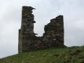
This article appeared in the Caithness Field Club Bulletin for 2013. Perched on a rocky hilltop overlooking the Kyle of Tongue this small tower was described in 1791 as, "a structure so antient, that there is no consistent tradition concerning it"i.
Search Our Site
Information
What's On
Submissions